
TL;DR

Prime made for students and young adults
- Fast, free delivery for dorm and study essentials
- Prime Video and Amazon Music included
- Member-only deals
Submarines rely on a combination of sonar, inertial navigation, and satellite signals to determine their location underwater. This process is complex and involves multiple systems working together, but some aspects remain classified or uncertain.
Submarines determine their position underwater primarily through a combination of sonar, inertial navigation systems, and satellite signals when near the surface. This multi-layered approach is crucial for navigation, especially given the inability to use GPS deep underwater, making precise location tracking a complex technological challenge.
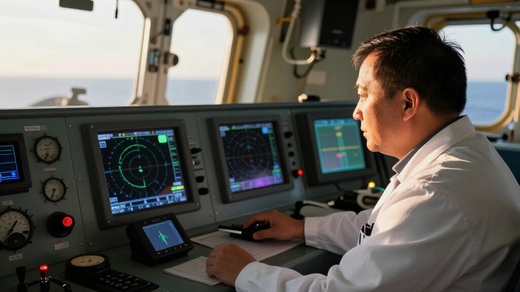
Confirmed methods used by submarines include sonar-based navigation, where active or passive sonar detects the environment and other vessels or seabed features. Learn more about sonar technology. They also rely on inertial navigation systems (INS), which use accelerometers and gyroscopes to track movement from a known starting point. When near the surface, submarines can access GPS signals, but these are not available underwater for extended periods.
Recent advancements involve underwater acoustic positioning systems, which use fixed seabed transponders to help submarines triangulate their location. For more on underwater navigation, see sonar technology. However, details about the full extent of these systems remain classified, and technical limitations such as signal attenuation and environmental noise pose ongoing challenges.
Understanding how submarines navigate is vital for national security, naval strategy, and underwater warfare. Accurate positioning allows submarines to operate stealthily, avoid detection, and execute missions with precision. The complexity and secrecy surrounding these navigation methods also highlight the technological edge held by leading military powers, making this knowledge strategically sensitive.
underwater sonar navigation system
As an affiliate, we earn on qualifying purchases.
As an affiliate, we earn on qualifying purchases.
Historically, submarines relied solely on inertial navigation, which accumulates errors over time. The advent of GPS provided a significant upgrade but is limited to surface or near-surface operations. In recent years, advancements in underwater acoustic systems and the development of seabed transponder networks have enhanced underwater positioning capabilities. Countries like the US, Russia, and China have invested heavily in these technologies, but full operational details remain classified.
inertial navigation system for submarines
As an affiliate, we earn on qualifying purchases.
As an affiliate, we earn on qualifying purchases.
Remaining Challenges and Classified Technologies
While the basic methods are known, many details about the latest systems, such as seabed transponder networks and advanced acoustic positioning, remain classified. It is unclear how widespread or effective these newer systems are across different navies, and some technological limitations, like signal degradation in complex environments, still pose problems.
underwater acoustic positioning transponders
As an affiliate, we earn on qualifying purchases.
As an affiliate, we earn on qualifying purchases.
Research continues into more accurate and covert underwater positioning systems, including autonomous underwater vehicles that can extend navigation capabilities. Advances in acoustic technology and underwater communication are expected to improve real-time location accuracy. However, the full scope of next-generation systems remains undisclosed, and ongoing secrecy suggests significant developments are still in progress.
As an affiliate, we earn on qualifying purchases.
Key Questions
How do submarines use sonar to find their location?
Submarines use sonar to detect environmental features, seabed contours, and other vessels. Active sonar emits sound pulses, while passive sonar listens for sounds from other sources, helping submarines identify their surroundings and estimate their position relative to known features.
Can submarines use GPS underwater?
GPS signals do not penetrate deep water effectively, so submarines cannot rely on GPS while submerged. They can access GPS only when near the surface or through snorkel mast communication, which limits continuous positioning accuracy.
What are seabed transponder networks?
Seabed transponder networks consist of fixed underwater beacons that emit acoustic signals. Submarines can triangulate their position by detecting these signals, providing a more precise location when in range.
Limitations include signal attenuation in complex environments, errors accumulating in inertial systems over time, and the limited range of acoustic systems. Additionally, many advanced methods are classified, and their operational effectiveness remains uncertain.
Source: rss
Halloween Picks
halloween
As an affiliate, we earn on qualifying purchases.