High-resolution climate models help you understand localized weather patterns by capturing the unique influences of urban areas and ocean-atmosphere interactions. These models simulate how buildings, roads, and human activities generate heat, affecting temperature and precipitation. They also show how changes in sea surface temperatures impact storm activity and rainfall. By using these insights, you can better predict climate variability in your area. There’s more to discover about their applications for climate change adaptation and planning.
Key Takeaways
- High-resolution climate models capture the complexities of urban microclimates, revealing how city structures influence localized weather patterns.
- These models simulate atmospheric and ocean interactions, providing insights into regional weather variations and extreme events.
- By analyzing granular data, high-resolution models enhance understanding of localized precipitation and temperature changes.
- Insights from these models assist local governments in developing targeted strategies for climate change mitigation and adaptation.
- Improved forecasting accuracy from high-resolution models supports preparedness for climate variability and extreme weather events.
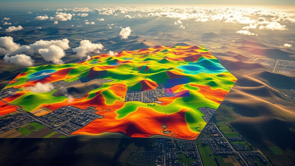
How do climate models help us understand our changing planet? They offer crucial insights into how various factors affect our environment, particularly when it comes to predicting localized weather patterns. High-resolution climate models are designed to capture the complexities of urban microclimates and the intricate ocean-atmosphere interactions that shape our weather. By simulating these processes at a granular level, you can gain a clearer picture of how climate change impacts your community, whether it’s through increased heat in city centers or altered rainfall patterns.
When you look at urban areas, you might notice that they experience different weather conditions than surrounding rural regions. This phenomenon is known as urban microclimates, and it occurs because of factors like buildings, roads, and human activities that generate heat. High-resolution climate models can help you understand how these microclimates develop and evolve over time. For instance, as cities expand, the increased heat from urban surfaces can lead to higher temperatures, affecting local weather systems. By using these models, researchers can predict where these heat islands will form and how they might influence precipitation patterns, air quality, and even energy consumption.
Moreover, the interactions between the ocean and the atmosphere play a vital role in shaping our climate. Oceans absorb vast amounts of carbon dioxide and heat, which affects weather patterns globally. High-resolution models can examine these ocean-atmosphere interactions in detail, allowing you to see how changes in sea surface temperatures can lead to shifts in storm activity or rainfall distribution. This is particularly important for understanding extreme weather events like hurricanes or droughts, which can have devastating effects on communities. Additionally, understanding the role of urban heat islands can aid in crafting effective mitigation strategies.
As you track climate changes through high-resolution models, you can also see how local governments and planners can make informed decisions. They can use these insights to develop strategies that mitigate the impacts of climate change, such as creating green spaces to combat urban heat or implementing water conservation measures in response to changing precipitation patterns.
In essence, high-resolution climate models are invaluable tools that deepen your understanding of localized weather phenomena. They not only clarify the dynamics of urban microclimates but also illuminate the vital ocean-atmosphere interactions that influence climate variability. With this knowledge, you can better prepare for the changes that lie ahead in your region.
Frequently Asked Questions
How Do High-Resolution Models Differ From Traditional Climate Models?
High-resolution models differ from traditional climate models primarily in data resolution and model scalability. You’ll notice that high-resolution models capture finer details, allowing for more accurate predictions of localized weather patterns. Traditional models often use broader data, which can overlook specific features. With high-resolution models, you get a clearer picture, enhancing your understanding of how climate factors interact on a smaller scale, ultimately improving forecasting capabilities and decision-making processes.
What Technology Supports These High-Resolution Climate Models?
High-resolution climate models rely on advanced satellite technology and supercomputing power. Satellites gather precise data on atmospheric conditions, land surface temperatures, and ocean currents, giving you detailed insights into weather patterns. Meanwhile, supercomputers process this vast amount of information rapidly, enabling accurate simulations and predictions. Together, these technologies enhance your understanding of localized weather, helping you make informed decisions based on the latest climate data.
How Accurate Are Localized Weather Predictions From These Models?
Localized weather predictions from high-resolution models can be surprisingly accurate, but they’re not infallible. Imagine a sunny day suddenly turning stormy; urban effects can skew outcomes, creating a stark contrast between expectations and reality. When you consider model resolution, finer details can enhance predictions, capturing microclimates that broader models miss. Yet, even with advancements, uncertainties remain, reminding you that while technology improves, nature often holds the ultimate surprise.
Can These Models Predict Extreme Weather Events?
Yes, these models can predict extreme weather events. By analyzing urban microclimates and incorporating data on atmospheric aerosols, they improve their accuracy. You’ll find that these models provide better forecasts for severe storms, heatwaves, and flooding when they factor in local conditions. As a result, you can be more prepared for potential disasters, helping you take necessary precautions and make informed decisions during extreme weather situations.
What Are the Limitations of High-Resolution Climate Models?
High-resolution climate models can struggle due to computational constraints, limiting their ability to simulate complex systems accurately. Did you know that even supercomputers can take weeks to process just a few days of high-resolution data? This makes timely predictions challenging. Additionally, model validation is essential; without extensive real-world data to compare against, you can’t be sure how reliable the model’s forecasts are, which can lead to uncertainty in extreme weather predictions.
Conclusion
Just like a skilled artist blends colors to create a vivid landscape, high-resolution climate models weave together data to paint a detailed picture of our weather. These models aren’t just numbers and charts; they’re the compass guiding us through the stormy seas of climate uncertainty. By understanding these localized patterns, we can better prepare for the tempests ahead, ensuring our communities weather the changes with resilience and grace, much like sturdy trees bending in the wind but never breaking.