
📊 Full opportunity report: The City That Watches Itself: The Living Digital Twin, And The God’s-Eye View We’re Building on ThorstenMeyerAI.com — validation score, market gap, and execution plan.

Get school and study supplies delivered free — and shop member deals
- Fast, free delivery on millions of items
- Access to Prime Big Deal Days deals on October 6–7
- Prime Video, Amazon Music and more included
TL;DR
Cities are creating dynamic digital twins that mirror real-time urban activity through advanced sensors and AI. This technology enhances planning but also raises significant surveillance and sovereignty concerns.
Cities are now building live digital replicas—called digital twins—that continuously record and simulate urban activity using advanced sensors and AI. These systems enable real-time monitoring, planning, and decision-making, but also introduce significant surveillance and sovereignty issues, making them a transformative yet controversial development.
The core of this technology involves creating a dynamic, three-dimensional virtual model of a city that integrates data from IoT sensors, satellite imagery, GIS, and utility networks. Cities like Singapore have developed comprehensive versions, such as Virtual Singapore, which models every building, road, and utility in real time, supporting urban planning and disaster response.
Recent technological convergence has enabled the twin to become live and continuously updated. Wide-Area Motion Imagery (WAMI) sensors track every vehicle and pedestrian, allowing analysts to rewind and follow individual movements. Layered with all-weather radar, satellite imagery, and AI, the model captures city life in full, regardless of weather or darkness.
The breakthrough is driven by advanced AI models capable of understanding complex data, recognizing patterns, and responding to natural language queries. This turns the city twin from a static map into an oracle-like system that can answer detailed questions or simulate scenarios such as infrastructure failures or evacuation plans.
While the benefits include improved urban planning, shorter development cycles, and enhanced rural management, the technology also raises concerns about mass surveillance, data sovereignty, and potential misuse. Some experts warn that cities could become vulnerable if their digital twins are controlled or manipulated by external actors or governments.
The city that watches itself: the living digital twin, and the god’s-eye view we’re building
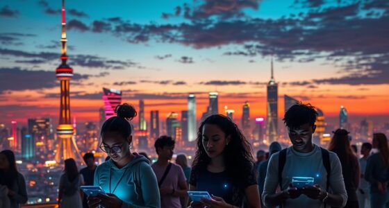
Soon most cities will exist twice — once in concrete, once as a live data model you can rewind, simulate, and question in plain language. Persistent sensing + frontier AI turn the planner’s digital twin into an oracle. The most useful thing we’ve built — and the most powerful surveillance instrument. Both at once.
- Plan better — cities & rural: traffic, zoning, energy, land use
- Emergency response — route crews, one live picture, ~50% faster
- Disaster resilience — simulate, track live, assess damage in hours
- Mass surveillance — track everyone, retroactively, forever
- Pattern-of-life — AI links movements, infers associations
- Social control — no warrant, no suspicion (cf. Baltimore, 2021 ruling)
We’re building a city that watches itself, remembers everything, and can be asked anything. The technology won’t choose between saving lives and ending privacy — we will, through the rules we write now, while the twin is still under construction and the defaults haven’t yet hardened into permanence. WAMI and the living twin open our lives to a view from the heavens that, from the dawn of civilization until a heartbeat ago, was reserved for gods and stars. The question is no longer whether we can see everything — it’s who gets to look, and who watches the watchers.
Implications for Urban Governance and Privacy
This development signifies a major shift in how cities are managed, with the potential to greatly improve efficiency, safety, and resource allocation. However, it also introduces risks related to mass surveillance and loss of sovereignty. As cities become more data-driven, questions about privacy, data ownership, and control become increasingly urgent. The dual-use nature of these systems means they can serve both civic needs and authoritarian oversight, making regulation and oversight critical.
As an affiliate, we earn on qualifying purchases.
Technological Foundations and Current Implementations
The concept of digital twins has been evolving for years, with early versions used mainly for urban planning and infrastructure management. Singapore’s Virtual Singapore launched after the 2012 floods, modeling the entire city in 3D with real-time data overlays. Cities like Helsinki and Las Vegas now operate operational city twins, reporting benefits such as cost savings and more accurate planning.
The recent leap comes from the integration of wide-area sensing technologies like WAMI and all-weather radar, combined with the latest AI models capable of understanding complex, heterogeneous data streams. This convergence transforms the twin into a living, interrogable city that can answer detailed questions and simulate scenarios, shifting governance from reactive to proactive.
“This technology offers unprecedented insight into urban dynamics, but it also raises profound privacy and sovereignty issues that must be addressed.”
— Professor Jane Doe, Urban Tech Expert
As an affiliate, we earn on qualifying purchases.
Unresolved Concerns About Control and Security
It is still unclear how widespread adoption will impact privacy laws or how governments and private entities will regulate these systems. The potential for external control or hacking remains a significant concern, especially given the reliance on AI models that could be manipulated or shut down by foreign actors or internal authorities.
As an affiliate, we earn on qualifying purchases.
Future Developments and Regulatory Challenges
Next steps include establishing international standards for data privacy and security, developing regulations to prevent misuse, and expanding digital twin deployments to more cities and rural areas. Monitoring how governments and private companies address sovereignty and privacy issues will be critical in shaping the future landscape of urban digital twins.
As an affiliate, we earn on qualifying purchases.
Key Questions
How do digital twins improve city planning?
They allow planners to simulate changes, predict outcomes, and optimize resource use before implementing physical projects, reducing costs and errors.
What are the main risks associated with city digital twins?
The primary concerns include mass surveillance, data privacy violations, loss of sovereignty, and potential hacking or manipulation of the systems.
Are digital twins used only for urban areas?
While most current deployments focus on cities, the technology is also applied to rural regions, forests, coastlines, and infrastructure corridors for environmental and resource management.
Who controls the data in a city’s digital twin?
This varies by city and jurisdiction, but control often rests with government agencies, private partners, or a combination, raising questions about ownership and oversight.
Could digital twins replace traditional urban planning?
They are tools to enhance planning, but human judgment and democratic processes remain essential. Digital twins provide data and simulations, not decisions.
Source: ThorstenMeyerAI.com
Fall Picks
fall essentials
As an affiliate, we earn on qualifying purchases.