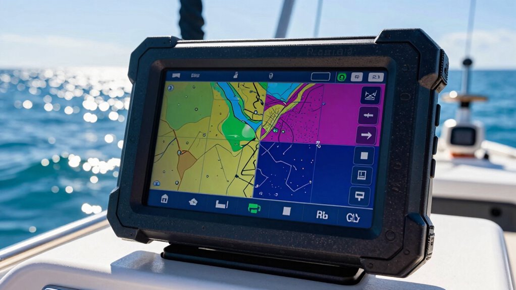

When selecting marine GPS units, the key considerations are display clarity, navigation accuracy, ease of use, and durability in harsh conditions. The Garmin ECHOMAP UHD2 74cv stands out as the best overall choice thanks to its sharp display and reliable performance. For those needing advanced charting features, the Garmin GPSMAP 943xsv offers impressive sideVü imaging, while budget-conscious buyers may prefer the Garmin ECHOMAP UHD2 54CV for its value. Navigating this market involves balancing price, features, and intended use, which can be tricky. Continue reading for a detailed breakdown of each option and what makes them unique.

Get school and study supplies delivered free — and shop member deals
- Fast, free delivery on millions of items
- Access to Prime Big Deal Days deals on October 6–7
- Prime Video, Amazon Music and more included
Key Takeaways
- High-resolution displays significantly improve visibility in bright sunlight, which the top picks prioritize.
- Choosing between touchscreen and physical controls impacts ease of use in rough conditions—touchscreens are intuitive but less glove-friendly.
- Advanced sonar and imaging features, like sideVü, are reserved for premium models and benefit fishermen and advanced boaters.
- Durability and waterproof ratings are essential; the best units withstand harsh marine environments without issue.
- Price varies widely, but spending more generally provides better charting, imaging, and connectivity features for serious users.
| Garmin ECHOMAP UHD2 74cv |  | Best Overall for Coastal and Lake Navigation | Model: ECHOMAP UHD2 74cv | Transducer: GT20-TM | Mapping: U.S. Coastal and Great Lakes | VIEW ON AMAZON | See Our Full Breakdown |
| Simrad GO Chartplotter and Fish Finder with Transducer and Radar Options |  | Best for Multi-Function Marine Integration | Display: Multifunction display | Chart Card: C-MAP DISCOVER | Transducer Support: CHIRP, DownScan | VIEW ON AMAZON | See Our Full Breakdown |
| Garmin GPSMAP 943xsv SideVü |  | Best for Advanced Marine Sonar Imaging | Sonar: Ultra high-def scanning | Panoptix support: Yes | Mapping: Pre-loaded | VIEW ON AMAZON | See Our Full Breakdown |
| Garmin ECHOMAP UHD2 54CV Chartplotter/Fishfinder |  | Best Compact Chartplotter with Dual Sonar | Display Size: 5 inches | Sonar Types: CHIRP, ClearVü | Connectivity: Wi-Fi | VIEW ON AMAZON | See Our Full Breakdown |
| Garmin GPSMAP 79sc Marine Handheld GPS with BlueChart g3 Coastal Charts |  | Best Rugged Handheld for Coastal Navigation | Water Resistance: IPX6 | Display: High-resolution color | Special Features: Floats, barometric altimeter | VIEW ON AMAZON | See Our Full Breakdown |
| Garmin ECHOMAP UHD2 94sv with GT56 Transducer, 9-Inch Touchscreen Chartplotter with Navionics+ U.S. Coastal Charts |  | Best Overall for Versatile Navigation and Fishing | Display: 9-inch touchscreen | Transducer: GT56-TM | Charts: Navionics+ U.S. Coastal | VIEW ON AMAZON | See Our Full Breakdown |
| Garmin GPSMAP 86sci Floating Handheld GPS with Coastal Charts and Satellite Communication |  | Best for Portable Marine Navigation and Emergency Communication | Display: 3-inch sunlight-visible | Water Resistance: Water-resistant, floats | Charts: BlueChart G3 coastal | VIEW ON AMAZON | See Our Full Breakdown |
| Garmin ECHOMAP UHD2 74sv with GT54 Transducer, 7” Touchscreen Chartplotter with Navionics+ U.S. Coastal Charts |  | Best Compact Chartplotter for Space-Conscious Boats | Display: 7-inch touchscreen | Transducer: GT54-TM | Charts: Navionics+ U.S. Coastal | VIEW ON AMAZON | See Our Full Breakdown |
| Garmin ECHOMAP UHD2 93sv with GT56 Transducer, 9″ Touchscreen Chartplotter, Garmin Navionics+ U.S. Inland |  | Best for Inland Lakes and Freshwater Anglers | Display: 9 inches | Transducer: GT56-TM | Maps: Navionics+ U.S. Inland | VIEW ON AMAZON | See Our Full Breakdown |
| Simrad GO Chartplotter and Fish Finder with Transducer and Radar Options |  | Best for Advanced Marine Systems Integration | Display: Multifunction display | Chart Card: C-MAP Discover | Sonar: Active Imaging 3-in-1 | VIEW ON AMAZON | See Our Full Breakdown |
| marine gps unit | Display | Connectivity |
|---|---|---|
| Garmin ECHOMAP UHD2 74cv | — | — |
| Simrad GO Chartplotter and Fis | Multifunction display | Wi-Fi, NMEA 2000 |
| Garmin GPSMAP 943xsv SideVü | Improved optics | — |
| Garmin ECHOMAP UHD2 54CV Chart | — | Wi-Fi |
| Garmin GPSMAP 79sc Marine Hand | High-resolution color | — |
| Garmin ECHOMAP UHD2 94sv with | 9-inch touchscreen | Wi-Fi, wireless sonar sharing, motor control |
| Garmin GPSMAP 86sci Floating H | 3-inch sunlight-visible | InReach compatible |
| Garmin ECHOMAP UHD2 74sv with | 7-inch touchscreen | Wi-Fi |
| Garmin ECHOMAP UHD2 93sv with | 9 inches | Wi-Fi, wireless to Force trolling motor |
| Simrad GO Chartplotter and Fis | Multifunction display | Mirror to smartphone/tablet, NMEA 2000 |
More Details on Our Top Picks
Garmin ECHOMAP UHD2 74cv
The Garmin ECHOMAP UHD2 74cv stands out as a comprehensive combo of fishfinding and navigation features, making it ideal for anglers and boaters who need detailed coastal and Great Lakes maps. Compared with the Garmin GPSMAP 943xsv, it offers more straightforward navigation without the high-end sonar capabilities, which is perfect for users primarily focused on fishing and general boating. Its detailed mapping, combined with a high-resolution display and included transducer, delivers clear images and reliable positioning, though it lacks some advanced sonar features. The main tradeoff is that it doesn’t offer the multi-function display or radar support of higher-end units, but this keeps it accessible and easy to operate. Ideal for boaters seeking reliable navigation combined with fishfinding in coastal and lake environments.
Pros:- Detailed coastal and lake mapping included
- Integrated transducer enhances fishfinding
- High-resolution display improves visibility
Cons:- Limited information on screen size and advanced features
- No built-in radar or network connectivity
Best for: anglers and boaters who prioritize detailed coastal and inland maps with integrated fishfinding.
Not ideal for: users wanting advanced sonar imaging or radar capabilities for large vessel or offshore use.
- Model:ECHOMAP UHD2 74cv
- Transducer:GT20-TM
- Mapping:U.S. Coastal and Great Lakes
Our verdict“This unit suits anglers and coastal boaters looking for reliable, straightforward navigation and fishfinding.”
Simrad GO Chartplotter and Fish Finder with Transducer and Radar Options
The Simrad GO9 offers a versatile multi-display capable of combining GPS, sonar, and radar, making it ideal for serious boaters and fishermen who want an all-in-one system. Unlike most single-purpose units like the Garmin GPSMAP 943xsv, it provides a seamless interface for managing navigation, fishfinding, and radar from a single touchscreen. Its support for detailed C-MAP charts and advanced sonar like CHIRP and DownScan allows for versatile underwater imaging, but setting up the system can be complex, often requiring technical knowledge. Additional radar and transducer options can increase costs significantly. This pick makes the most sense for experienced boaters seeking a comprehensive, integrated system for navigation, fishing, and safety.
Pros:- Combines GPS, sonar, and radar in one device
- Supports detailed C-MAP charts for US and Canada
- Remote access via Wi-Fi and smartphone connection
Cons:- Setup complexity may require technical skills
- Additional radar and transducer costs add up
Best for: experienced boaters needing integrated GPS, sonar, and radar with system expandability.
Not ideal for: casual boaters or those with small vessels who prefer simple, plug-and-play units without complex setup.
- Display:Multifunction display
- Chart Card:C-MAP DISCOVER
- Transducer Support:CHIRP, DownScan
- Connectivity:Wi-Fi, NMEA 2000
Our verdict“This system is best for experienced boaters seeking a feature-rich, all-in-one navigation and fishfinding solution.”
Garmin GPSMAP 943xsv SideVü
The Garmin GPSMAP 943xsv excels with ultra high-definition scanning sonar and Panoptix support, making it suitable for anglers and tech-savvy boaters who prioritize imaging quality. Its advanced sonar capabilities surpass those of the Garmin ECHOMAP UHD2 74cv, offering detailed underwater views and versatile scanning options. Pre-loaded maps make navigation straightforward, but the high-end features come with a higher price tag, and there’s limited info on user reviews or specs. Its optics improvements enhance clarity, but the unit’s complexity and cost make it less suitable for casual users. This unit is tailored for advanced fishers and anglers needing superior sonar imaging.
Pros:- Ultra high-definition scanning sonar
- Supports Panoptix for versatile scanning
- Pre-loaded mapping simplifies navigation
Cons:- High cost for advanced features
- Limited detailed specs and user reviews
Best for: experienced anglers and tech enthusiasts seeking cutting-edge sonar imaging and navigation.
Not ideal for: casual boaters or those new to marine electronics who may find the features overwhelming and costly.
- Sonar:Ultra high-def scanning
- Panoptix support:Yes
- Mapping:Pre-loaded
- Display:Improved optics
Our verdict“This is a prime choice for anglers invested in high-definition sonar imaging and detailed underwater scans.”
Garmin ECHOMAP UHD2 54CV Chartplotter/Fishfinder
The Garmin ECHOMAP UHD2 54CV offers a compact 5-inch display with dual sonar views, including CHIRP traditional and ClearVü scanning, making it suitable for anglers who need detailed underwater images in a small form factor. Its bright display and Wi-Fi connectivity enable easy data sharing, though the limited screen size restricts multi-function multitasking. It supports high-quality LakeVü g3 and BlueChart maps with Navionics data, providing accurate navigation in a smaller package. Compared to larger units like the Garmin GPSMAP 943xsv, it sacrifices screen real estate but remains effective for smaller boats or as a secondary unit. The main drawback is its size limitation, which can restrict detailed viewing or multiple data overlays.
Pros:- Bright, easy-to-read 5-inch display
- Dual sonar views for underwater detail
- Wi-Fi for simple data sharing
- Includes high-quality mapping options
Cons:- Limited screen size restricts multitasking
- Requires compatible chartplotters for Wi-Fi sharing
Best for: anglers who need reliable, detailed sonar in a compact, easy-to-mount device.
Not ideal for: users seeking large, multi-pane displays or advanced integrated systems.
- Display Size:5 inches
- Sonar Types:CHIRP, ClearVü
- Connectivity:Wi-Fi
- Mapping:LakeVü g3, BlueChart
Our verdict“This unit suits anglers needing a reliable, compact fishfinder and chartplotter with detailed sonar capabilities.”
Garmin GPSMAP 79sc Marine Handheld GPS with BlueChart g3 Coastal Charts
The Garmin GPSMAP 79sc combines rugged durability with reliable marine navigation, making it ideal for boaters needing a portable, water-resistant device. Its high-resolution color display, preloaded BlueChart g3 maps, and support for multiple satellite systems ensure accurate tracking and easy route planning. Unlike larger chartplotters, this handheld floats, which simplifies retrieval if dropped, and its long battery life of up to 20 hours supports extended outings. While its IPX6 water resistance is adequate for most marine conditions, it might not withstand heavy spray or submersion. Its increased portability, however, makes it less suitable for comprehensive onboard navigation or integration into larger systems. This device is perfect for coastal explorers and anglers who need a durable, portable GPS.
Pros:- Rugged, waterproof, and floating design
- Supports multiple satellite systems for accurate positioning
- Preloaded BlueChart g3 maps
- Long battery life up to 20 hours
Cons:- IPX6 may not withstand prolonged heavy water exposure
- Limited to handheld portability, less suitable for onboard use
Best for: coastal anglers, kayakers, or boaters requiring a reliable handheld GPS that can be used on the water or ashore.
Not ideal for: users seeking a full-featured, fixed mount system for onboard navigation or radar integration.
- Water Resistance:IPX6
- Display:High-resolution color
- Special Features:Floats, barometric altimeter
- Memory:10,000 waypoints
- Satellite Support:GPS, GLONASS, Beidou, Galileo
- Battery Life:Up to 20 hours
Our verdict“This handheld GPS is ideal for coastal adventurers needing a rugged, reliable device with extensive battery life.”
Garmin ECHOMAP UHD2 94sv with GT56 Transducer, 9-Inch Touchscreen Chartplotter with Navionics+ U.S. Coastal Charts
The Garmin ECHOMAP UHD2 94sv stands out for its large, sunlight-readable 9-inch touchscreen, offering clear visibility even in bright conditions. Its inclusion of detailed Navionics+ U.S. Coastal charts makes it highly suitable for coastal navigation, while the GT56 transducer supports traditional, ClearVü, and SideVü sonar, making it a strong choice for anglers seeking both navigation and fishing features. Compared with the smaller Garmin UHD2 74sv, this model provides a bigger display and more detailed charts, though it comes with a higher price tag and potentially more complex setup. Wireless connectivity enables data sharing and remote control of compatible trolling motors, adding convenience but requiring compatible gear for full functionality. This pick makes the most sense for boaters who want a combined navigation and fishing device with a large display and comprehensive sonar capabilities.Pros:- Bright, sunlight-readable 9-inch touchscreen display
- Includes detailed Navionics+ U.S. Coastal charts
- Supports multiple sonar modes with GT56 transducer
- Wireless sharing and motor control capabilities
Cons:- Requires compatible trolling motor for full wireless control
- Higher price point compared to smaller or simpler units
- Complex setup may challenge novices
Best for: Serious anglers and coastal boaters needing a large, feature-rich touchscreen with integrated sonar and charting.
Not ideal for: Casual boaters or beginners who may find the advanced features and setup process overwhelming.
- Display:9-inch touchscreen
- Transducer:GT56-TM
- Charts:Navionics+ U.S. Coastal
- Connectivity:Wi-Fi, wireless sonar sharing, motor control
Our verdict“This is a top-tier choice for experienced boaters seeking a large, versatile device for navigation and fishing.”
Garmin GPSMAP 86sci Floating Handheld GPS with Coastal Charts and Satellite Communication
The Garmin GPSMAP 86sci is designed for boaters who need a compact, portable GPS that can float and withstand water exposure, making it ideal for quick deployments and emergency use. Its preloaded BlueChart G3 coastal charts provide reliable navigation support in various marine environments, while the inReach satellite communication offers SOS, weather updates, and real-time location sharing—features unavailable in larger chartplotters like the Garmin ECHOMAP UHD2 94sv. Compared to the larger Garmin UHD2 models, the 86sci sacrifices screen size for portability and ruggedness, which can be a drawback if detailed chart viewing is a priority. The small display and subscription requirements for satellite features may limit usability for some users. This device suits boaters who prioritize portability, emergency communication, and basic navigation in open waters.Pros:- Water-resistant, floating design for safety
- Preloaded BlueChart G3 coastal charts
- Satellite communication with SOS and tracking
- Compact and easy to carry
Cons:- Small 3-inch display may be hard to read in bright sunlight
- Requires subscription for satellite features and weather updates
- Limited to basic navigation and communication functions
Best for: Kayakers, paddleboarders, or boaters needing a durable, portable GPS for safety and navigation.
Not ideal for: Users looking for a large screen for detailed chartplotting or fishing integration, as the small display limits detailed viewing.
- Display:3-inch sunlight-visible
- Water Resistance:Water-resistant, floats
- Charts:BlueChart G3 coastal
- Satellite Communication:InReach with SOS
- Connectivity:InReach compatible
Our verdict“This device is ideal for boaters who need a rugged, portable GPS with emergency communication features.”
Garmin ECHOMAP UHD2 74sv with GT54 Transducer, 7” Touchscreen Chartplotter with Navionics+ U.S. Coastal Charts
The Garmin ECHOMAP UHD2 74sv offers a 7-inch sunlight-readable touchscreen, making it well-suited for boats with limited space. Its inclusion of Navionics+ U.S. Coastal charts ensures reliable navigation along the coast, while the GT54 transducer supports traditional, ClearVü, and SideVü sonar modes for fishing. Compared to the larger 94sv, this model is more portable and easier to install on smaller boats, but it sacrifices some screen real estate and potentially advanced features. Wi-Fi connectivity supports wireless data sharing and trolling motor control, although full functionality depends on compatible gear. This unit is perfect for boaters who want a smaller footprint without sacrificing core navigation and sonar features.Pros:- Compact 7-inch sunlight-readable display
- Preloaded Navionics+ U.S. Coastal charts
- Supports traditional and detailed sonar modes
- Wireless sharing and trolling motor connectivity
Cons:- Smaller screen can be less convenient for detailed viewing
- High cost for a smaller unit with advanced features
- Requires compatible trolling motor for full control
Best for: Small boat owners and anglers seeking a straightforward, space-efficient chartplotter with reliable sonar.
Not ideal for: Fishers or navigators who prefer a larger display for detailed viewing or plan to use advanced features regularly.
- Display:7-inch touchscreen
- Transducer:GT54-TM
- Charts:Navionics+ U.S. Coastal
- Connectivity:Wi-Fi
Our verdict“This is a solid choice for boaters needing a space-saving, reliable chartplotter with essential sonar functions.”
Garmin ECHOMAP UHD2 93sv with GT56 Transducer, 9″ Touchscreen Chartplotter, Garmin Navionics+ U.S. Inland
The Garmin ECHOMAP UHD2 93sv is designed for inland and freshwater use, featuring a bright 9-inch touchscreen and Navionics+ inland maps covering over 18,000 lakes. Its GT56 transducer supports traditional sonar, ClearVü, and SideVü, making it highly capable for structure and fish detection in lakes and rivers. Compared to coastal-focused units like the 94sv, this model emphasizes inland detail, which benefits freshwater anglers. Wireless connectivity allows for remote sharing of sonar data and control of compatible trolling motors, but the larger size may require ample mounting space, and setup can be complex for less experienced users. It’s ideal for anglers who prioritize inland navigation and detailed lake maps over coastal features.Pros:- Bright, 9-inch sunlight-readable display
- Includes comprehensive inland maps for over 18,000 lakes
- Supports multiple sonar modes with GT56 transducer
- Wireless data sharing and remote motor control
Cons:- Larger size may limit mounting options in smaller boats
- Setup complexity can challenge beginners
- Focused on inland lakes, not ideal for open coast navigation
Best for: Freshwater anglers and boaters targeting lakes and rivers with a need for detailed inland maps and sonar.
Not ideal for: Coastal boaters or those primarily fishing offshore, as inland maps do not provide marine detail.
- Display:9 inches
- Transducer:GT56-TM
- Maps:Navionics+ U.S. Inland
- Connectivity:Wi-Fi, wireless to Force trolling motor
Our verdict“This chartplotter excels for freshwater use, offering detailed inland maps and versatile sonar in a user-friendly format.”
Simrad GO Chartplotter and Fish Finder with Transducer and Radar Options
The Simrad GO9 combines GPS navigation, sonar, and radar support into a highly versatile multifunction display. Its preloaded C-MAP Discover charts provide detailed coastal and inland data, while the Active Imaging 3-in-1 sonar delivers crisp images of fish and structures—ideal for serious anglers and multi-system users. Unlike Garmin’s dedicated chartplotters, the GO9’s strength lies in its ability to integrate with radar and NMEA 2000 systems, making it suitable for larger, more complex vessels. However, its complexity and need for additional hardware for radar may be overwhelming for casual boaters. This device makes the most sense for experienced users seeking a comprehensive, expandable onboard system.Pros:- Multifunction display supporting GPS, sonar, and radar
- Includes detailed C-MAP Discover charts
- Active Imaging 3-in-1 sonar provides clear, detailed images
- Supports system expansion and connectivity
Cons:- May be too complex for beginners
- Additional radar hardware increases overall cost
- Price not specified, often expensive
Best for: Experienced boaters and anglers looking for a multifunction system with radar, advanced sonar, and extensive charting capabilities.
Not ideal for: Casual boaters or those new to marine electronics, due to its complex setup and higher cost.
- Display:Multifunction display
- Chart Card:C-MAP Discover
- Sonar:Active Imaging 3-in-1
- Connectivity:Mirror to smartphone/tablet, NMEA 2000
- Radar Compatibility:Yes
Our verdict“This is a robust choice for experienced boaters needing an integrated, expandable navigation and fish-finding system.”

How We Picked
The products in this roundup were evaluated based on several criteria that matter most to marine users. Performance in navigation accuracy, screen resolution, and ease of operation were primary factors, along with build quality and waterproof ratings. We also considered the value offered for different budgets, ensuring there are options for beginners up to advanced boaters. Each unit’s versatility—such as additional sonar capabilities or networking features—helped determine its ranking. Our goal was to highlight models that balance reliability, usability, and features tailored to a variety of marine activities.| marine gps unit | Connectivity |
|---|---|
| Garmin ECHOMAP UHD2 74cv | — |
| Simrad GO Chartplotter and Fis | Wi-Fi, NMEA 2000 |
| Garmin GPSMAP 943xsv SideVü | — |
| Garmin ECHOMAP UHD2 54CV Chart | Wi-Fi |
| Garmin GPSMAP 79sc Marine Hand | — |
| Garmin ECHOMAP UHD2 94sv with | Wi-Fi, wireless sonar sharing, motor control |
| Garmin GPSMAP 86sci Floating H | InReach compatible |
| Garmin ECHOMAP UHD2 74sv with | Wi-Fi |
| Garmin ECHOMAP UHD2 93sv with | Wi-Fi, wireless to Force trolling motor |
| Simrad GO Chartplotter and Fis | Mirror to smartphone/tablet, NMEA 2000 |
Factors to Consider When Choosing Marine Gps Units
When choosing a marine GPS unit, it’s essential to consider factors that affect your experience on the water. The right device should match your boating style, technical skill level, and environment. Beyond the specs, understanding how features impact real-world use can prevent costly mistakes and ensure long-term satisfaction. Here are key considerations to guide your selection.Display Size and Resolution
A clear, bright display is vital for quick interpretation of navigation data, especially in direct sunlight. Larger screens with higher resolution reduce eye strain and improve detail visibility, which is crucial when reading charts or sonar imaging at a glance. However, bigger displays can add to the cost and may require more mounting space, so balance size with your boat’s layout and your budget.Navigation and Charting Capabilities
Accurate and detailed charts are the backbone of effective navigation. Look for units that support your preferred charting services, whether Garmin’s BlueChart or Navionics+. Compatibility ensures you get the most current and detailed maps. Also, consider whether the unit offers auto-routing, waypoint management, or advanced features like tide and current data, which are valuable for longer trips or unfamiliar waters.Sonar and Imaging Features
If fishing or detailed underwater imaging matters to you, focus on units with integrated sonar or sideVü capabilities. Premium models typically include high-frequency transducers that reveal fish and underwater structures clearly. Keep in mind that these features often come at a higher price and may require additional accessories, so assess how much value they add to your boating activities.Ease of Use and Interface
A user-friendly interface reduces frustration, especially in stressful situations. Touchscreens offer intuitive navigation but can be less reliable in wet or glove-wearing conditions. Physical buttons or rotary controls can be more robust but less modern. Consider your comfort with technology and the environment in which you’ll operate the unit to select controls that suit your style.Build Quality and Durability
Marine environments demand rugged, waterproof devices that can withstand salt, spray, and temperature fluctuations. Check the IP or IEC waterproof ratings—higher ratings typically mean better protection. A durable, well-sealed unit minimizes maintenance and extends the lifespan of your investment, particularly if you spend significant time on the water.Frequently Asked Questions
Should I prioritize a touchscreen or physical controls in my marine GPS?
Choosing between a touchscreen and physical controls depends on your typical operating conditions. Touchscreens are intuitive and allow quick access to functions, but they can be less reliable when wet or with gloves. Physical buttons or rotary controls offer more tactile feedback and are easier to operate in rough conditions, though they might have a steeper learning curve. Consider your comfort with technology and the environment where you’ll use the device most often.Is it worth investing in a unit with advanced sonar features?
If fishing or underwater exploration is a priority, investing in a model with advanced sonar or sideVü imaging can provide significant benefits. These features reveal fish, structures, and bottom contours in detail, enhancing your chances of success. However, they come with higher costs and may require additional transducers. For casual boaters or those mainly cruising, simpler units without sonar might be more cost-effective.How important is waterproof rating for my marine GPS?
A high waterproof rating, such as IPX7 or higher, ensures your device can withstand splashes, rain, and immersion without damage. Since marine environments are harsh, durability is critical to avoid costly repairs or replacements. When choosing, verify the rating and consider units with sealed connectors and rugged casings to handle the rigors of saltwater and rough handling.Can I use a handheld GPS as my primary marine navigation device?
Handheld GPS units are portable and useful for quick reference or backup, but they often lack the large displays, detailed charts, and advanced features of dedicated marine units. For serious boating, a mounted system offers better visibility, integration with sonar, and more comprehensive charting. However, a handheld can complement your primary system or serve well for small boats and nearshore trips.How much should I expect to spend on a good marine GPS unit?
Prices for marine GPS units vary widely, from budget options around $200 to premium models exceeding $1,000. Basic units with essential navigation features can serve casual boaters well, while advanced models with high-resolution screens, detailed charts, sonar, and networking capabilities are better suited for serious anglers or commercial use. Consider your budget alongside your specific needs to find the best value.Conclusion
For general boating and fishing enthusiasts, the Garmin ECHOMAP UHD2 74cv offers a balanced mix of features and affordability. If you need the most detailed imaging and advanced charting, the Garmin GPSMAP 943xsv stands out as the premium choice. Beginners or casual users should consider simpler, user-friendly options like the Garmin ECHOMAP UHD2 54CV. Serious anglers or those requiring rugged, feature-rich systems should look at models with enhanced sonar and connectivity, such as the Garmin ECHOMAP UHD2 94sv. Your ideal choice hinges on your boating style, budget, and how much you rely on detailed navigation or imaging features.Halloween Picks
halloween
As an affiliate, we earn on qualifying purchases.